Technology for Advanced Public Transport Priority and Efficient Freight Movement.
Bus and Tram and Transport Priority and Tracking.

The TRANSnet application is designed to actively monitor public transport journey and travel times throughout city areas and provide extremely advanced Public Transport Priority and Performance Reporting functions. The system is a multi-user map-based application that processes live bus location information in real-time.
Virtual Detector zones are created on the map surface by a privileged operator. All drawing, editing, configuration, reporting tools etc are incorporated into the package. There is no need to introduce roadside detection systems to deploy TRANSnet.
A ‘Parameter List’ is associated with each Virtual Detector. Each parameter list contains a complete set of “rules” that are required to be met to trigger priority actions. Logical Or / And functions can be applied to these rules so that any one of multiple different scenarios can trigger a priority condition. A comprehensive Calendar Scheduler allows different threshold parameters to be applied to any virtual detector by time-of-day, day of week, etc. This allows for different priority operation for Peak Periods, Weekends, Public Holidays, etc. The Calendar Scheduler is completely pre-programmable, and incorporates recurrency controls so that specific ‘Normal Event’ parameters can always automatically be applied by Weekday, Day of Week, Weekends, for next ‘x’ occurrences etc.
Once priority is applied at an intersection, the system continually checks the trigger conditions, and can also escalate priority if required. Escalation is via a progressive linked-list so that there is essentially no upper limit to the number of different types of further priority that can be applied. For example, initial priority might be provided by giving additional phase time to an approach, this could ‘escalate’ if required to change a split plan, increase a cycle length, then to provide a green wave, or to dwell one of more junctions if required.
Trigger conditions are continually monitored. Once the trigger conditions are no longer met, the system can automatically introduce a ‘Cleanup’ procedure to revert the intersections back to normal operation (e.g. remove trims / cycle locks etc).
The system can be programmed to control more than one intersection once a trigger condition is detected. For example, if a bus is detected behind schedule, corresponding cycle-length or phase-times might be increased at intersections further downstream to provide additional priority to assist to proactively restore the schedule, rather than waiting for the vehicle to be detected at other specific locations before commencing further priority improvements.
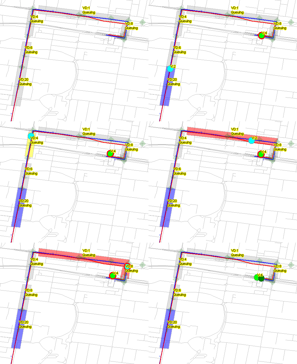
Action Blocking is also incorporated. Once the number of ‘priority’ events applied at a location has been exceeded within a given time, further priority assistance can be blocked for a specified period. The system incorporates two types of detectors: Queue and Journey Time, allowing localised and broader journey time priority management to be implemented & controlled.
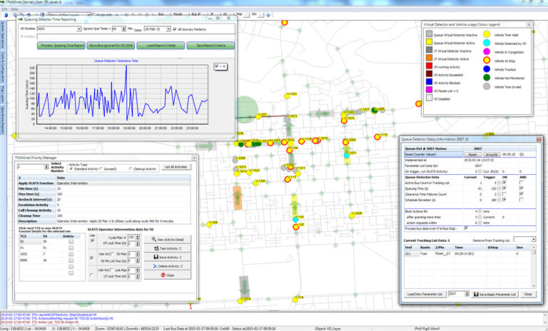
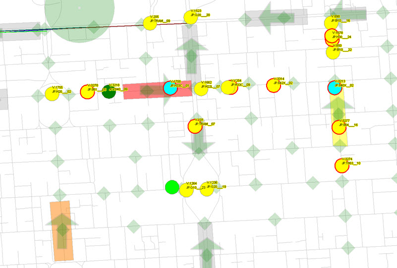
Multiple map layers are used to display road network, buses, detectors, bus stops, traffic signals, bus garages etc. The user has total control over which map layers are displayed.
The status of all detectors, buses, triggers etc are easily identifiable on the graphical map display, with specific colour-coding being used to allow immediate identification of precise conditions. Queuing time can be accumulated or subtracted from the threshold values if it occurs while the bus is ‘At Bus Stop’. This is programmable on a detector-by-detector and time-of-day basis.
The system works with SCATS(*) but can be adapted to work with virtually any traffic management system.
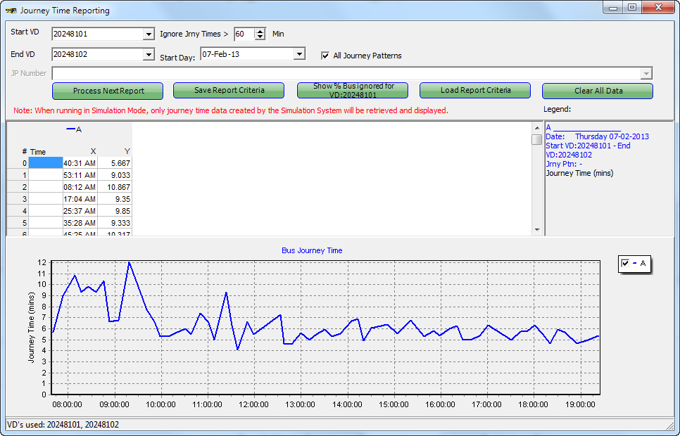
Comprehensive performance reporting on vehicle journey times (absolute, average, exponentially weighted etc) is also available and presented to the user via graphical (chart) and tabulated data displays. Once any report criteria has been defined, it can be optionally saved and recalled at any time for undertaking comparative performance purposes.
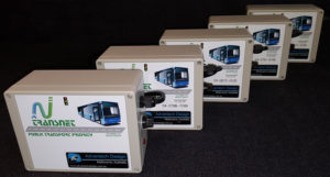
TRANSnet Tracker Units
TRANSnet has been adapted to utilise our own vehicle location transponders. The Advantech Design on-board vehicle-tracking transponders utilise 48 channel, high-sensitivity GPS receivers in conjunction with an integrated secure 3G wireless modem, and are used to provide vehicle location, speed and other relevant data to the TRANSnet system. The devices transmit public transport vehicle position information to the TRANSnet Communications Server, which collects and manages all field equipment data, and transmits this in real-time to the TRANSnet Database Loader. All wireless communications are transmitted over secure VPN connections, are protected by unique account and passwords, and incorporate dedicated IP addresses.
The physical units are quite compact, measuring 165 x 125 x 80 mm, and are usually mounted in the ‘Destination Display’ area of the bus. Other location preferences can easily be considered where appropriate.
The above only provides a brief description of the many feature incorporated into this extremely comprehensive Public Transport Priority Management and Reporting system. We believe that the TRANSnet Public Transport application implemented by Advantech Design is essentially the most advanced Public Transport Priority System ever deployed in the world today.
Advantech Design has more than 30 years experience in the electronics and communications industry and the development of ITS applications both within Australia and for Authorities throughout the world. Our proven track record in leading edge ITS solutions is testimony to our long-term commitment to the industry.
Please Contact Us for more information
TRANSnet is a registered Trademark of Advantech Design P/L
* SCATS is a registered trademark of the Roads and Maritime Services, NSW, Australia

